So, on Saturday last week I thought to myself: how about I hike up the Zugspitze tomorrow? And so I did.
Okay, well the story is slightly longer than that. I was originally planning to go hiking “somewhere in the mountains” with a colleague. When said colleague answered neither messages nor phone calls the day where we were supposed to plan the trip, I was quite disappointed. But I couldn't let that stop me, I'd been looking forward to it the entire week. So when it became clear I wasn't going to get an answer, a thought popped up in my head: I'm already in Munich, why not aim as high as I can and hike up the Zugspitze?
For those who don't know: the Zugspitze is Germany's tallest mountain with a height of 2962 meters.
In any case, what might seem like a reckless thing to decide at 17:00 the day before actually turned out to be fairly doable. Some quick research showed that it is indeed quite possible to climb the Zugspitze in a day. From what I found out, there's mainly six different routes, out of which two are “easy”. Easy in this case means there's no additional equipment such as climbing gear or shoe spikes needed, like on the other four routes. I went with the Reintal route which is regarded as the easiest (though also longest) one.
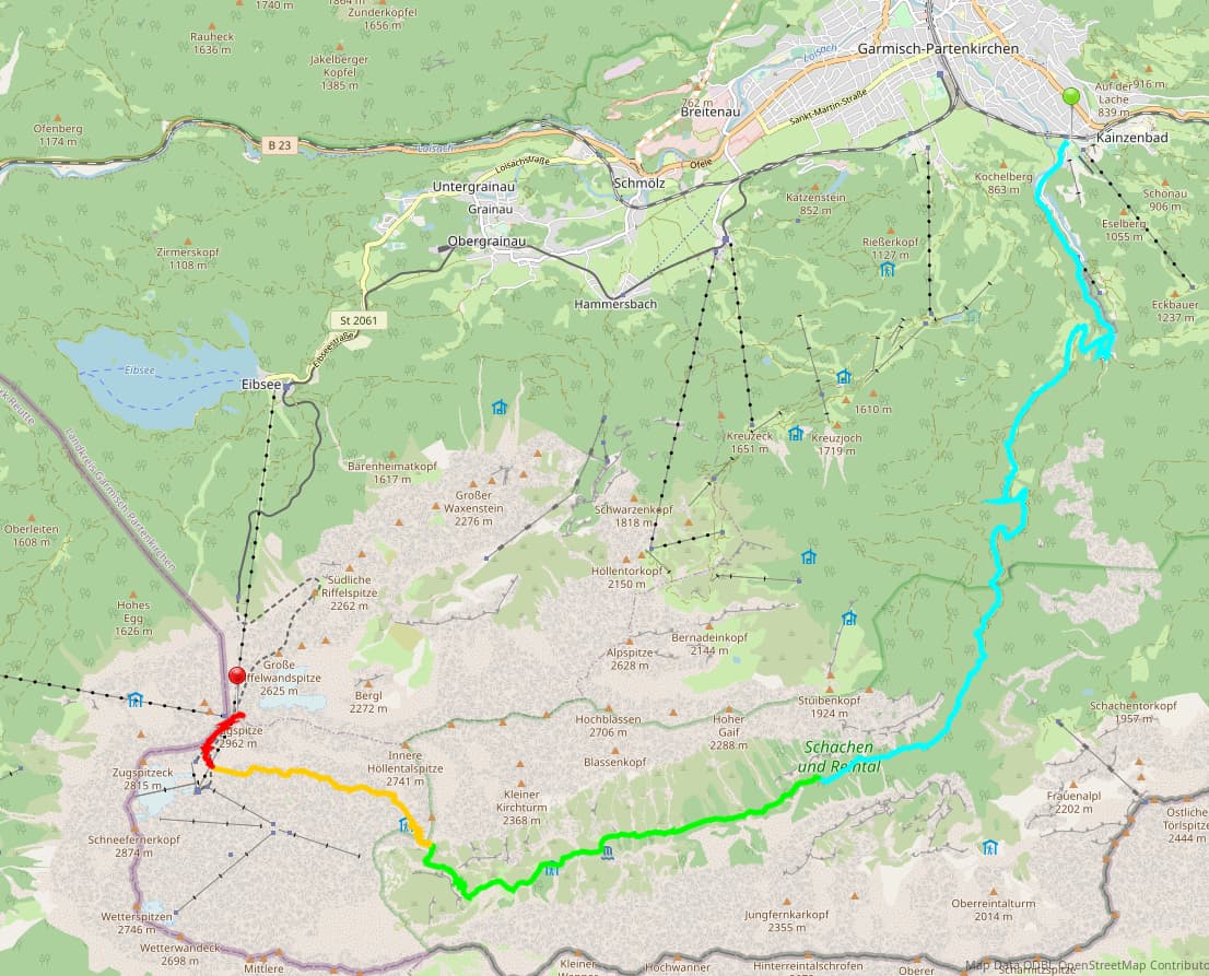
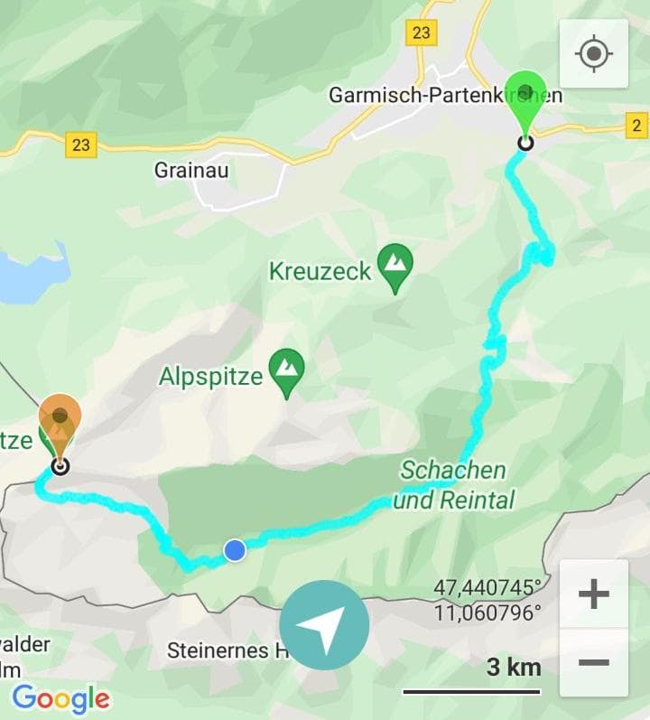
The Reintal route starts at Garmisch-Partenkirchen in the northeast of the Zugspitze, then goes almost straight south through the Partnachklamm gorge, following the Partnach river through the Reintal to the east and then southeast of the Zugspitze, before finally climbing the steep rock and gravel walls on the south side of the peak.
Internet says the route is supposed to take ten hours, or “nine or eight if you're really fast”. These estimates are typically quite a bit longer than how long it actually takes for me, though I guess I'm not the average person (heh), and it's also supposed to stop people from underestimating dangerous routes. Anyway, I wasn't going to do this unprepared, so I went shopping the day before for some extra ressources I would need. Finally got me some hiking socks, bought another big bottle of water so I can carry 2.5 liters in total and also prepared a lunch sandwich, a bunch of snacks and some bananas as rations. I also got me some SPF 50 sunscreen against the mountain sun and packed my trusty hat that I bought back in 2018 for New Zealand. I checked the weather forecast and it was gonna be sunny and very warm all day. Which is good, I suppose, better than rain which would also make the route quite dangerous towards the end. Having finished my preparatory shopping, I went to bed at 20:00, since I was planning to get up at 4:00 the next day.
My degree of spontaneity paid off came back to bite me here, as, naturally, I wasn't able to fall asleep for a couple hours. So I woke up at 4:00 with about 5 hours of sleep, but feeling surprisingly refreshed and ready to do it. I ate some quick breakfast I'd prepared the day before, checked the weather again and packed the remainder of my stuff while watching the sun peek above the horizon. When I took another look at the Deutsche Bahn app, to make sure that trains are on time, I realized for the first time that a train had derailed on the track somewhere shortly before Garmisch-Partenkirchen, so I'd have to take a bus replacing the trains (SEV) from the last station, Oberau, right before that. A bit of a shame, but oh well. It would only delay my arrival by about 40 minutes, which shouldn't be a big problem since I don't have a tight schedule anyway. A quick bike ride to Munich main station, and I sat down in the RB6 regional train to Oberau at 5:32.
I spent most of my train ride reading Tank Men by Robert Kershaw. It's a really interesting book detailing the development of tanks and tank warfare, and most importantly highlighting the life of the tank crews living and fighting in these vehicles during the first and second world war. I highly recommend it to anyone interested in world war history, warfare, tanks and/or the human factor.
After arriving in Oberau, I hopped on the SEV to Garmisch-Partenkirchen. Looking out of the window, I got my first glimpse of the mountains.
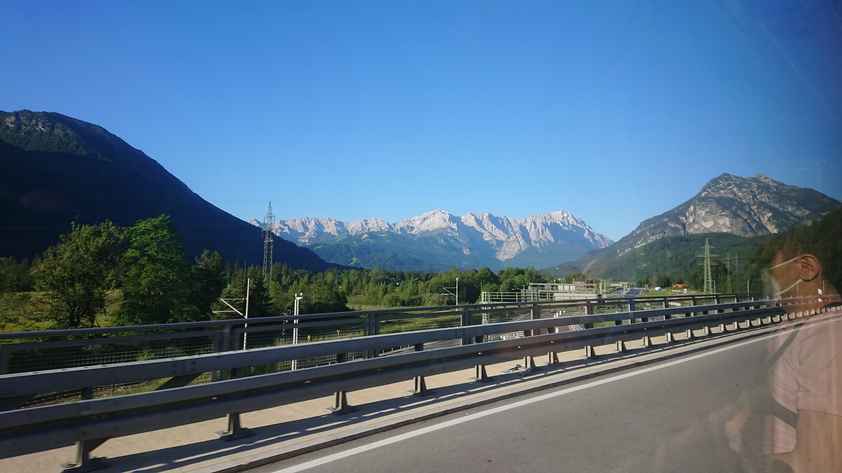
I knew I was going to climb up those mountains, and my excitement began to well up again.
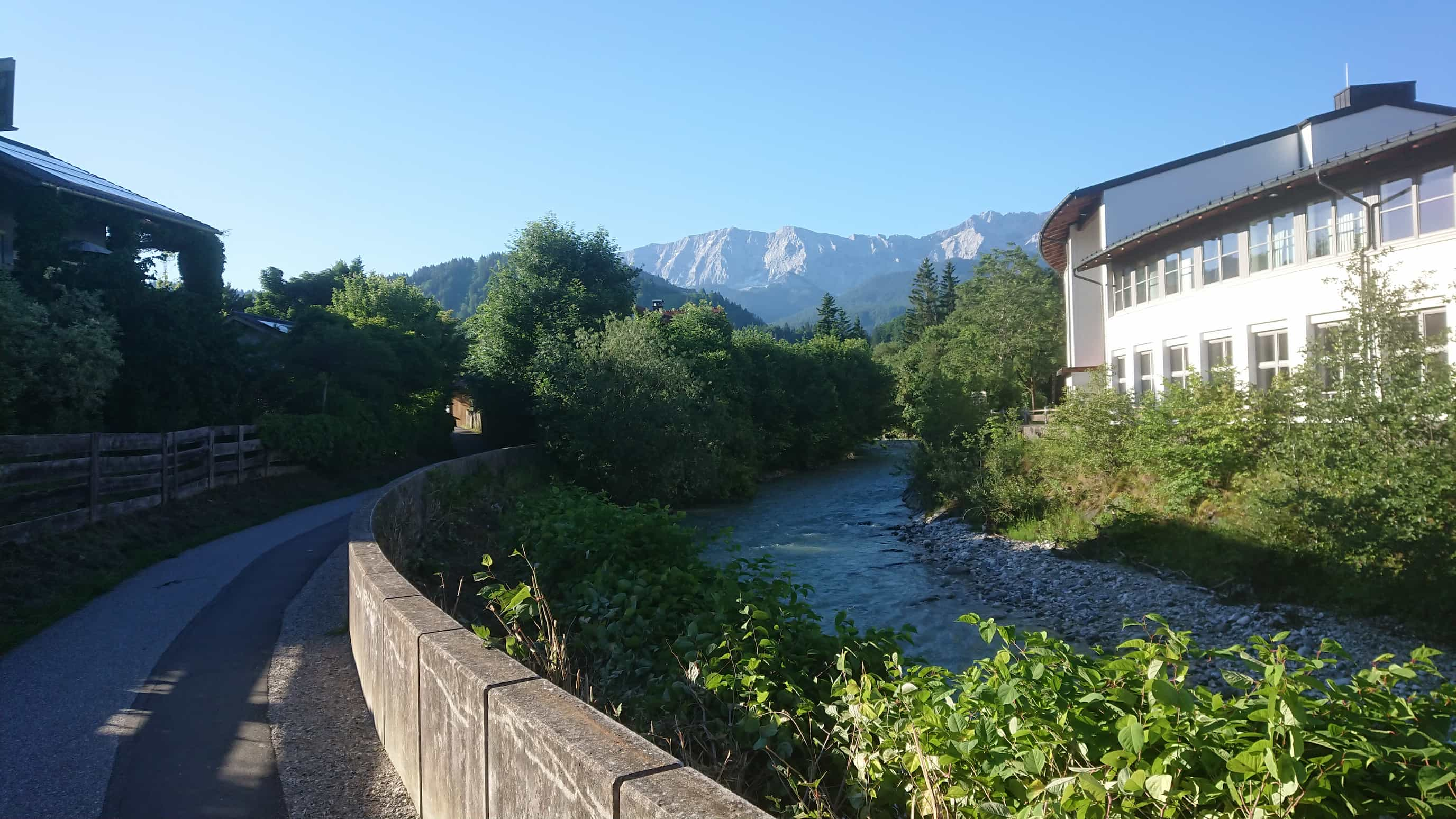
I arrived in Garmisch-Partenkirchen at around 7:40. After a brief period of disorientation, I began walking towards the start of the track. I was a bit confused as everyone who was on the bus with me walked in a different direction, but whatever.
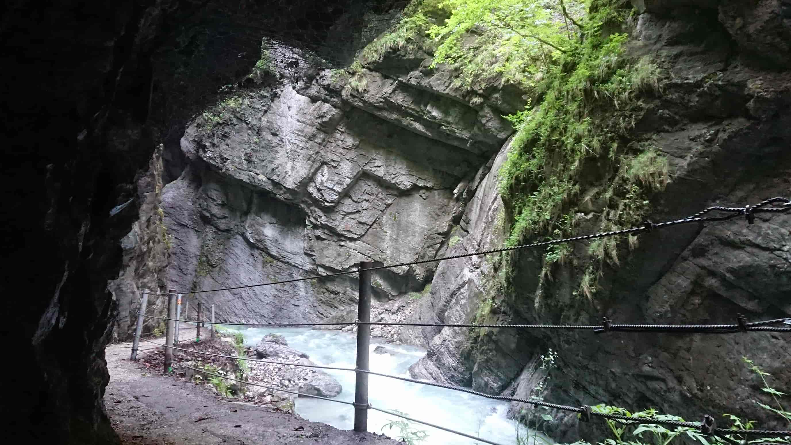
I eventually saw the first signs that said “Partnachklamm” and “Zugspitze” at the outset of the forest, and arrived at the entrance to the Partnachklamm shortly after that. You actually need to pay an entrance fee of 6€ for the Partnachklamm, or otherwise take a big detour. I didn't really care, so I paid the fee and entered the gorge. This was also the moment I realized I would have had to wait here anyway, if I hadn't been late due to the SEV between Oberau and Garmisch-Partenkirchen, as they only open at 8:00 apparently. Anyway, I didn't regret paying for this, as the gorge was really cool.
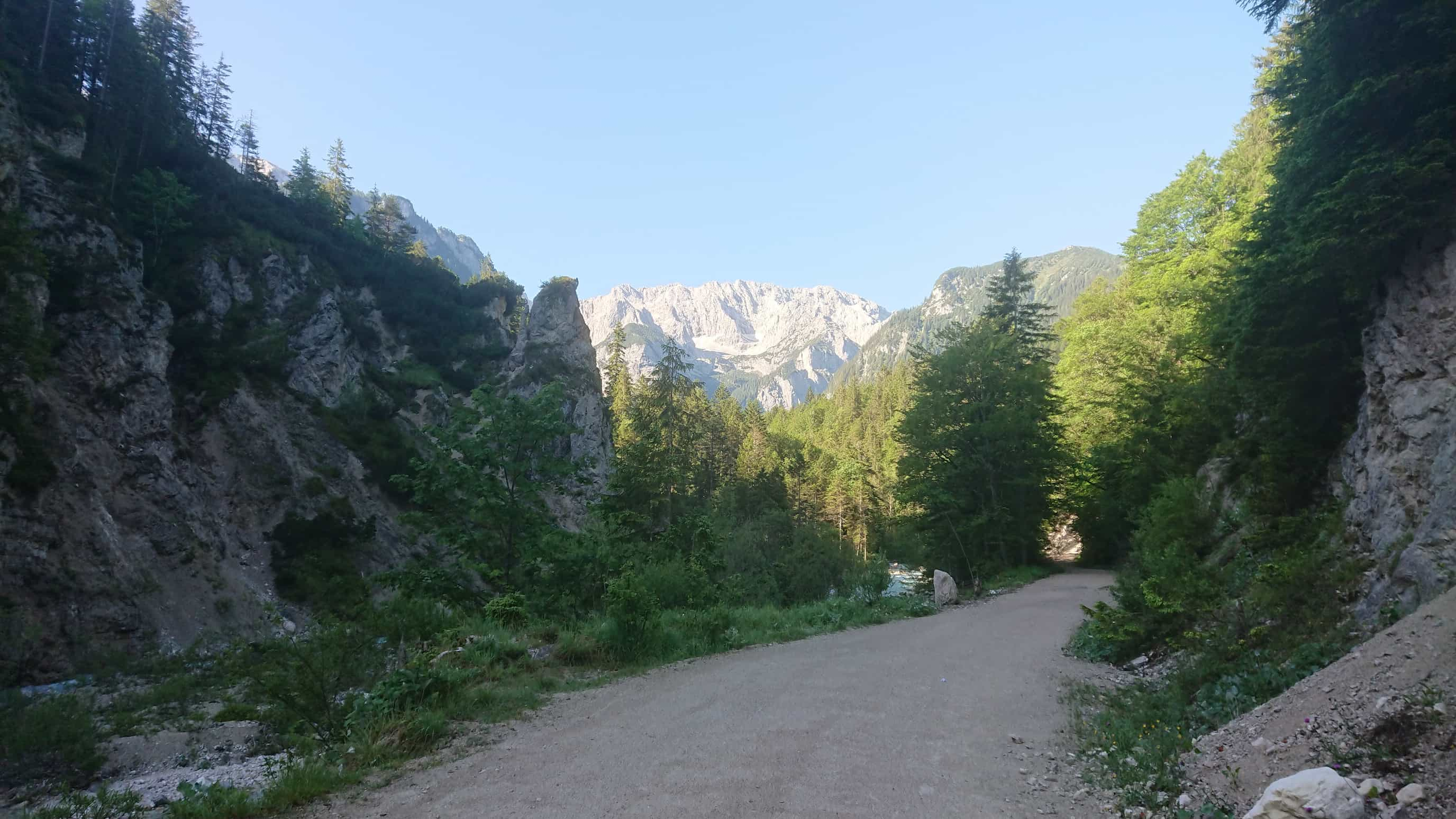
After the Partnachklamm, I followed the Partnach river along an easy route through the forest. Being able to see the mountain peaks in the distance was pretty cool, and also motivated me to keep a strict pace.
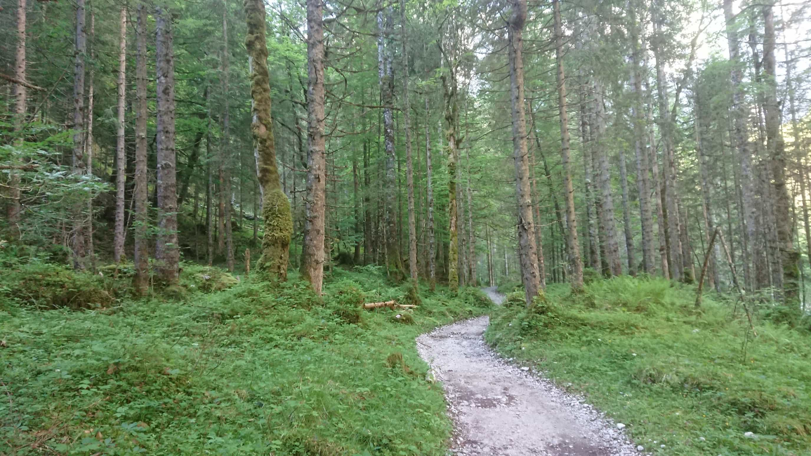
There was this couple I met along the way. I passed them since I was walking faster, and then at some point 20 minutes later, I… passed them again? We were all quite confused and spent the next five minutes pondering how that could have happened. Around that time, the forest was getting lighter, so I finally took out my hat from the backpack and put on some sunscreen. Turns out my predictions were off, since I entered the deepest part of the forest after that.
But it was only a short while before it opened up. Wedged between mountains, I walked a gravel path following the Partnach river. I had entered the Reintal valley.
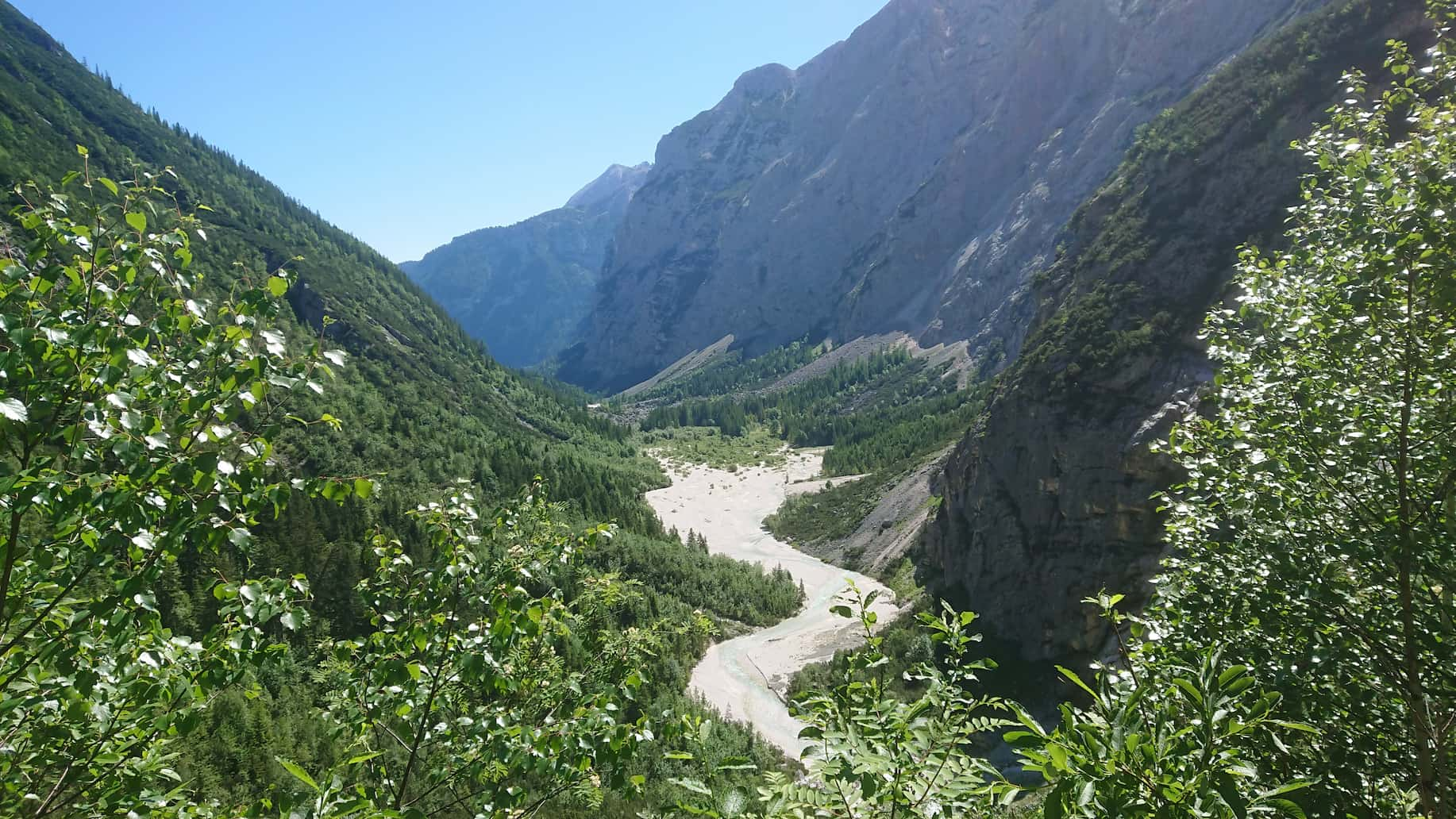
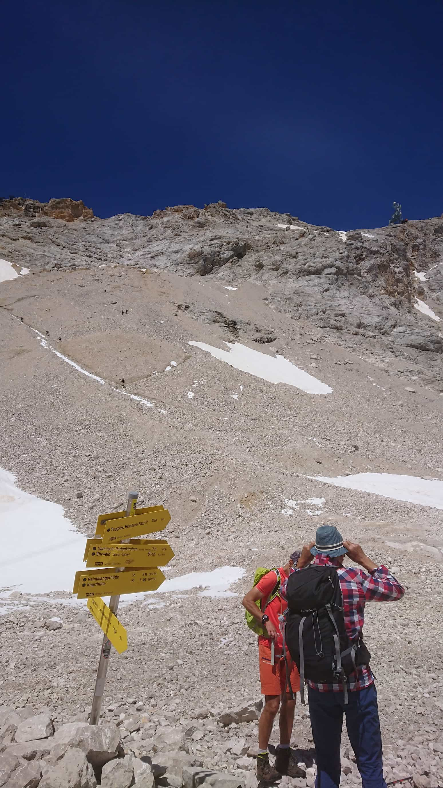
This part of the route was perhaps the most boring. I walked the Reintal for about 10km, and while the mountains to the left and right are nice to look at, when the scene doesn't really change at all for two hours, then that's a bit meh. Anyway, I reached the end of the valley and arrived at the first hut: the Reintalangerhütte. I took the chance to check the time and the map, and realized: wow, I already finished three quarters of the route? In only three hours?
That's crazy! Only about 5km left until I reach the top, I thought. I took another look at the hut, and saw the sign above the entrance that indicated the current elevation to be 1370m. Wait, so I'm still missing 1600m? And I only managed 500m so far? Well, it can't be that bad, right?
This is foreshadowing.
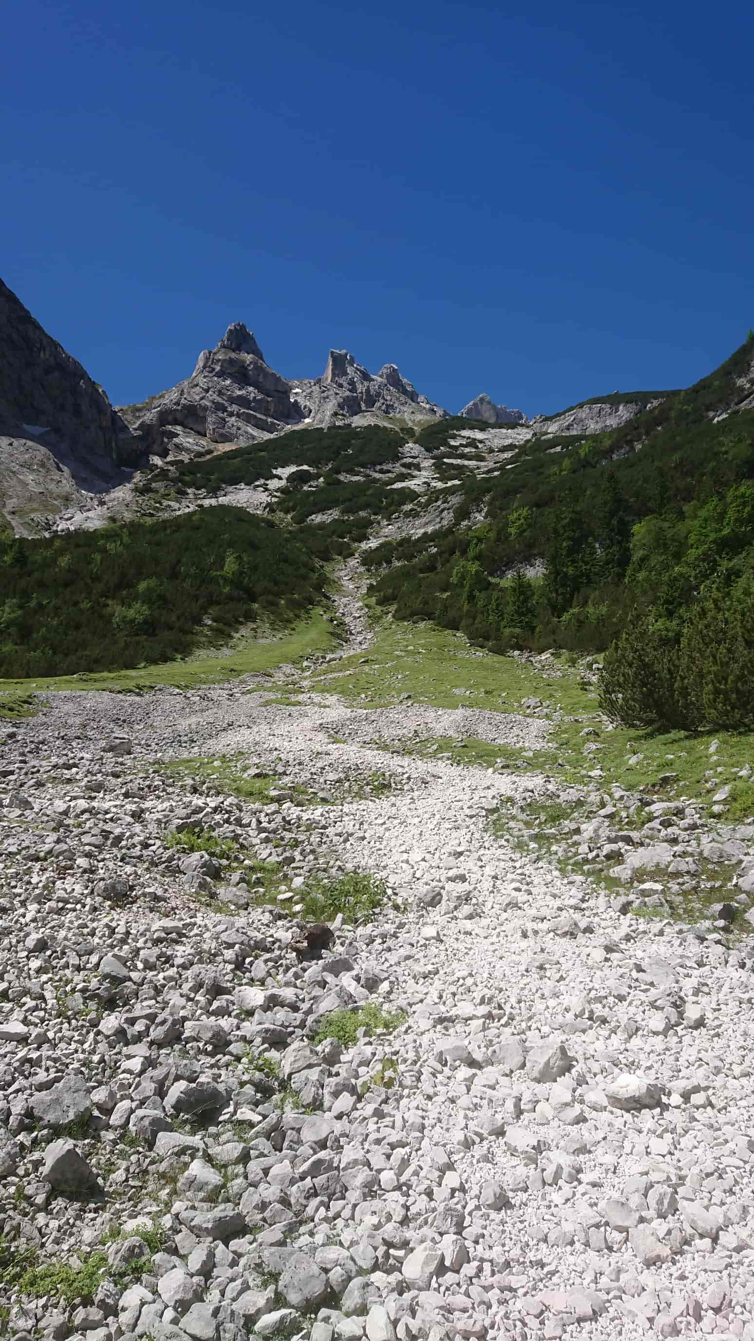
Shortly afterwards, I arrived at a steep, rocky, gravel-y wall. This is where it gets serious, this is where the real climb begins, I realized.
I started walking up there, and really felt my heart pumping for the first time on that trip. I told myself I'd try to get to the top without taking a rest, except for quick breaks to replenish my water reserves. It was so difficult and very tiring, but I could do it! After about an hour, I reached a small plateau where I met a group of travellers taking a break. One of them asked me if I knew how far it is to the peak from here. I told him I had no idea, and then he said he's “pretty sure we made about 500m already”. Hold on, I thought, this must have been way more than 500m?
I said goodbye to those people and set out to climb the next “wall”. The guy probably has no idea, I thought.
The path became a bit harder after that. In fact, at some point it got almost impossible to recognize any “path” at all. I stopped looking for something that looked like a path, instead I looked for places where the pure grey rock was tinted slightly brownish by the dirt under people's shoes. That's pretty much the only thing that kept me from getting lost, as I was literally just walking up a mountain flank with no signs, no paths and no orientation whatsoever.
Half an hour and what felt like all my remaining stamina reservers later, I arrived at another hut, the Knorrhütte. The tavern keep was standing at the veranda when I arrived and greeted me with a smile: “You made it!”
“YES, I MADE IT!”, I screamed. Just inside my head of course. I wasn't at the tip of the mountain yet, obviously, but I must be close I thought, as I sat down on one of the benches on the veranda. Then I looked at the sign above the entrance to the hut, which indicated the height. This is also the moment that depression hit.
2052 meters.
What the fuck?, I thought. The previous section that cost me all my stamina was only seven hundred meters!? And there's still 900 ahead of me?
iT cAn'T bE tHaT bAd RiGhT
… wow, I'm an idiot I realized.
Breaking with my vow that I would make it to the top without a break, I decided to relax at the Knorrhütte for just a bit. I ordered some Kaiserschmarrn, which was really good, disregarding that it cost fifteen euros. Well, I really didn't care in that situation.
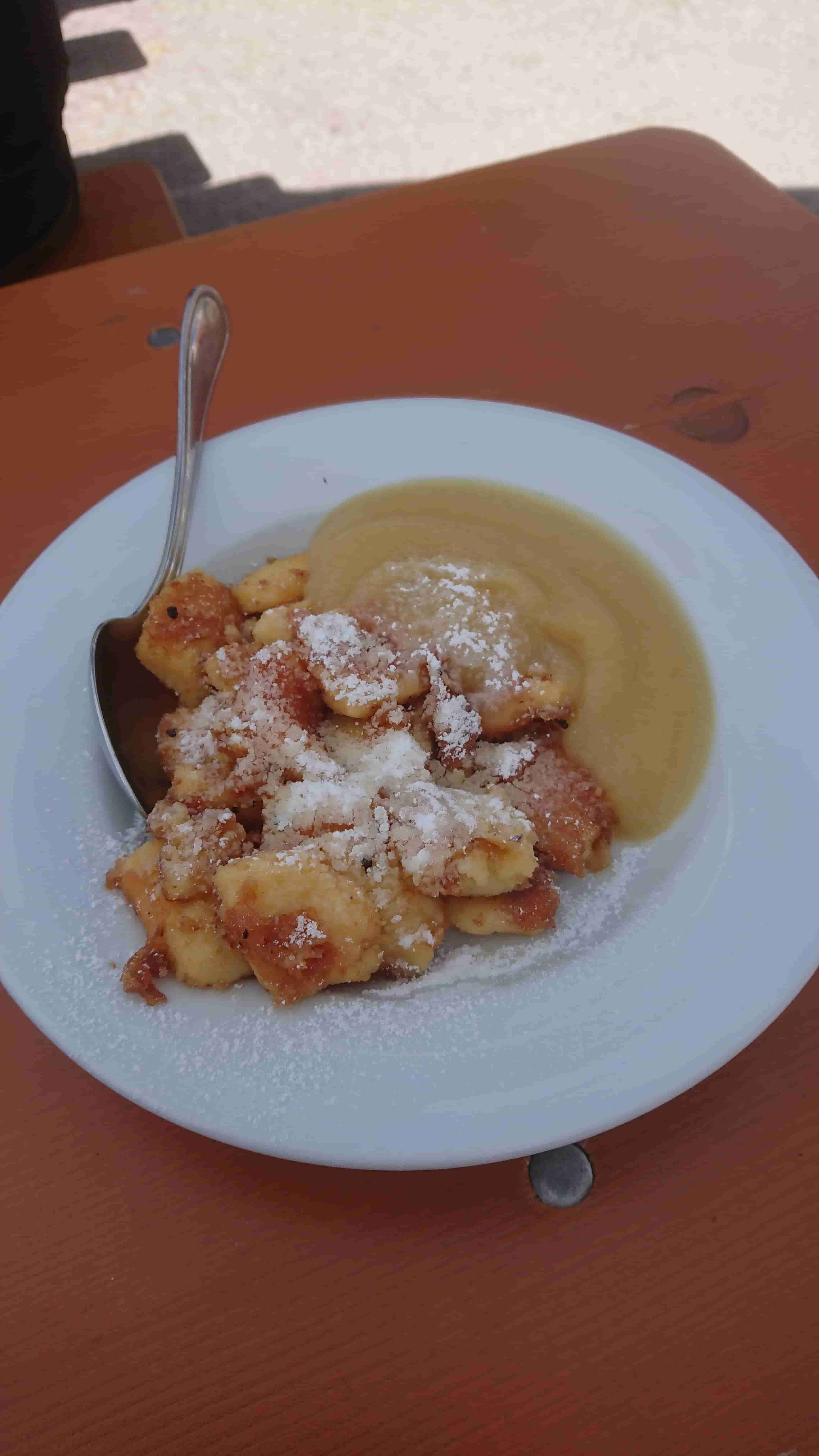
I ate up my Kaiserschmarrn, renewed my sunscreen just in case, paid and then moved on. Now I had a good idea what lay in front of me, and I wouldn't be disappointed again.
The hike actually got slightly easier after that. The slope was a bit less steep here, and I felt a cool breeze every now and then. Not too long after that, I started to see snow.
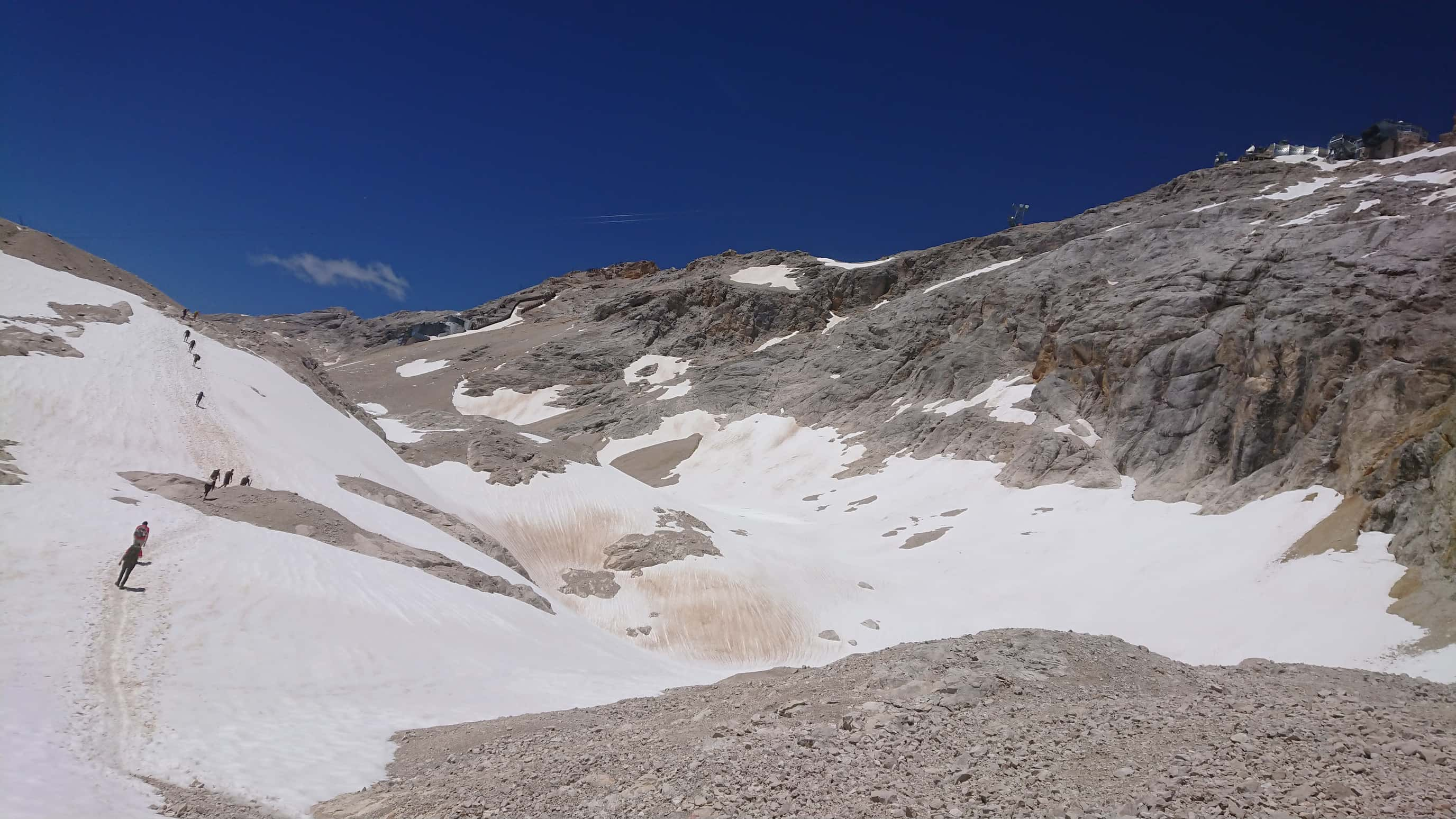
I'm seriously wondering how the snow stayed frozen up there. The sun was still blazing down on me with all its might and I absolutely would have liked it another 10 degrees cooler, if I had the choice. There's no way this was anywhere near 0°C I felt. Some hiking through snow ensued here, though never for too long. A good hour (including a couple breaks) later, I arrived at the last cable cars. Just another 400m of elevation from this point, I remembered. There's also the option of taking the cable cars up to the peak for the last section. I didn't do that of course. The route may have gotten easier, but I was completely exhausted. Still, there's no way I'd chicken out here. It's all or nothing. After another short break, I tackled the last part of the route, the last steep wall.
This was easily the steepest part so far and all semblance of a path was gone. Everyone went slightly different ways here, whatever worked out for them. When I was unsure earlier whether I should call it walking or climbing, now I was certain: this is climbing. Or at least, the fact that I used my hands half the time was a strong indicator for this.
At this point, I had to take breaks to catch my breath about every 10 to 20 meters of elevation. I don't know whether this was the mountain air getting to me (didn't really notice it otherwise) or just a sign of my exhaustion. Probably both? My legs were struggling to keep up at this point. There were several moments where I felt like my left leg was just going to give out and let me drop, though I barely avoided that every time.
After covering about half of the remaining 400m, the slope got noticably steeper yet again. But at the same time, there was a steel cable running along the wall. This was much appreciated and actually made the remainder of the route easier. For the first time, I was able to really use my arms and take some of the weight off my legs. That said, this is also the point where the route actually got dangerous. Until now, I never felt like I was risking anything by doing this hike. Sure, the rock and gravel paths I walked/climbed up earlier were steep, but they didn't fall off to the sides or anything. Even if you lost your balance and fell over towards the back, you'd just hit your back on the rocks half a meter lower. But here, it was different. There were several places where the steel cable was strictly necessary to be able to continue at all. Letting go or losing your grip would likely mean falling down a couple (dozen) meters. This was the first time I felt like I could seriously hurt or even kill myself if I fucked up.
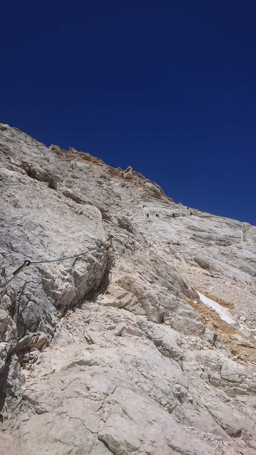
That didn't happen and I continued without any trouble. As I said, the rope actually made the route easier. There were tens of people somewhere ahead and behind me walking the same route and they all made it up there safely. I guess it's a bit like standing on the edge of the roof of a tall building. You're not strictly in danger if you don't do something dumb (or someone wants you dead), but you're acutely aware that you're only one step away from a life-threatening situation.
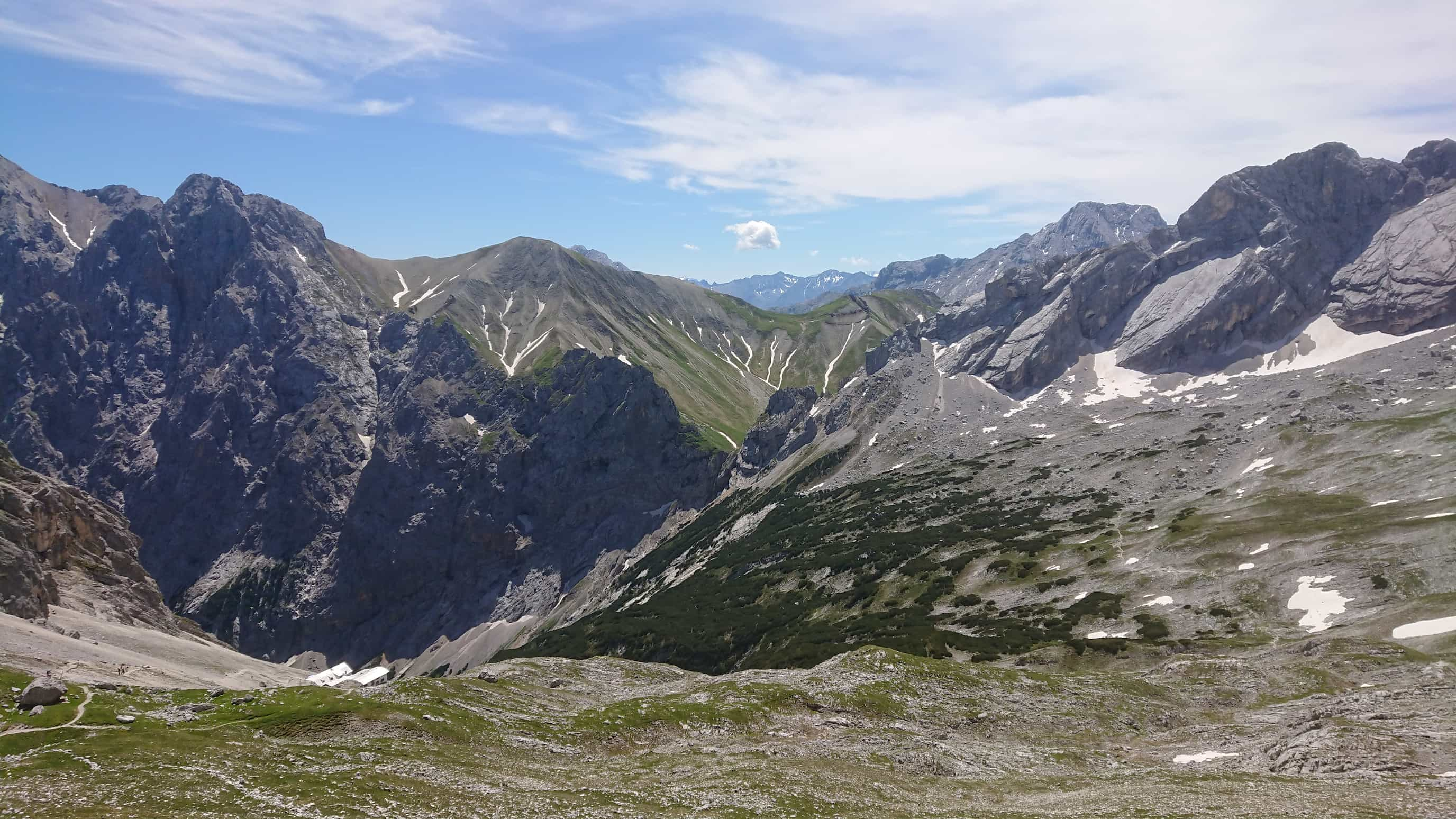
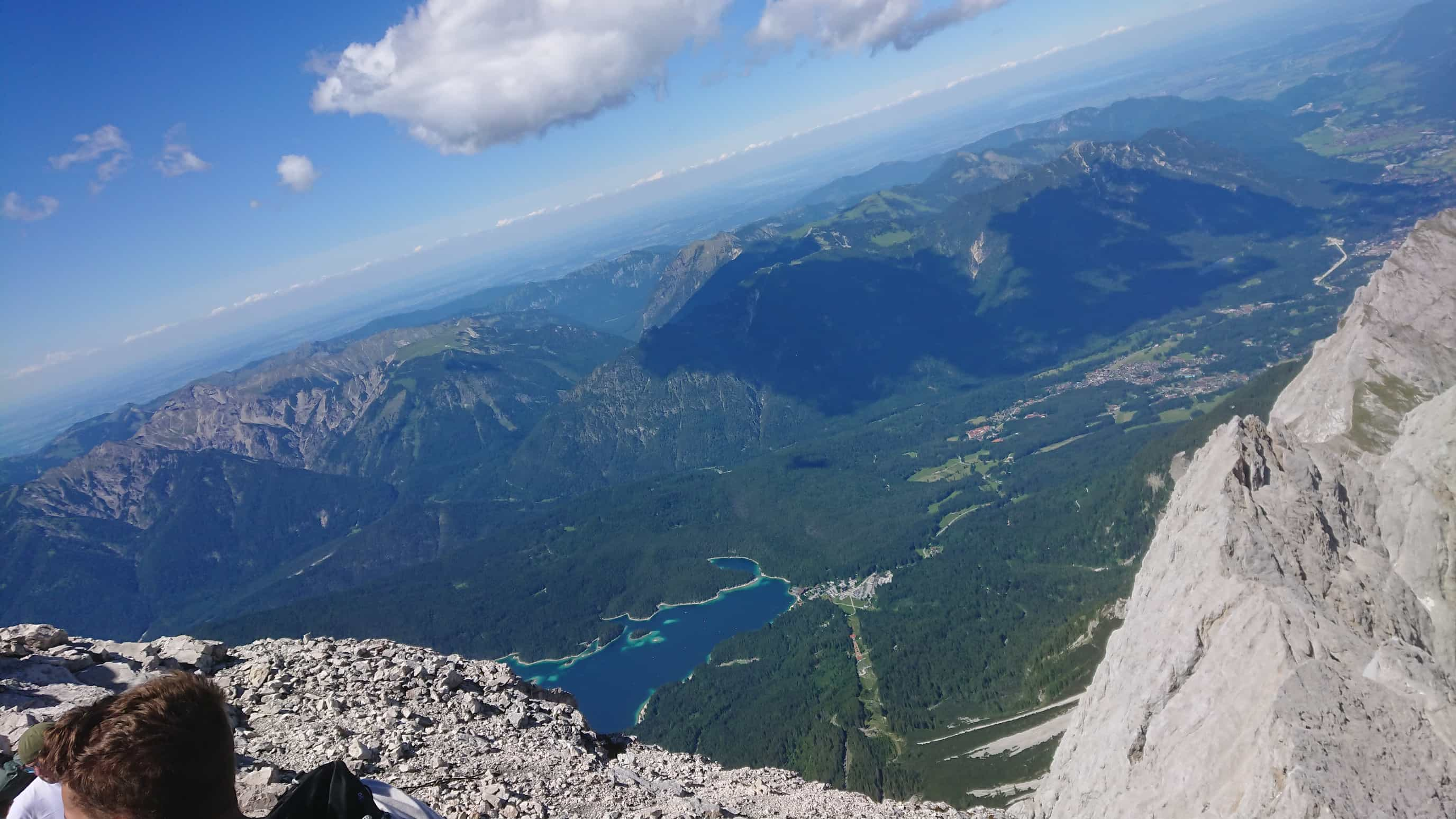
Other than that, it was smooth sailing though. At some point I pulled myself up towards a ridge. Completely unexpected and out of nowhere, everything opened up in front of me. I had been looking at that steep wall or the ground in front of me for the past couple hours, and suddenly I had an amazing view across the land below me.
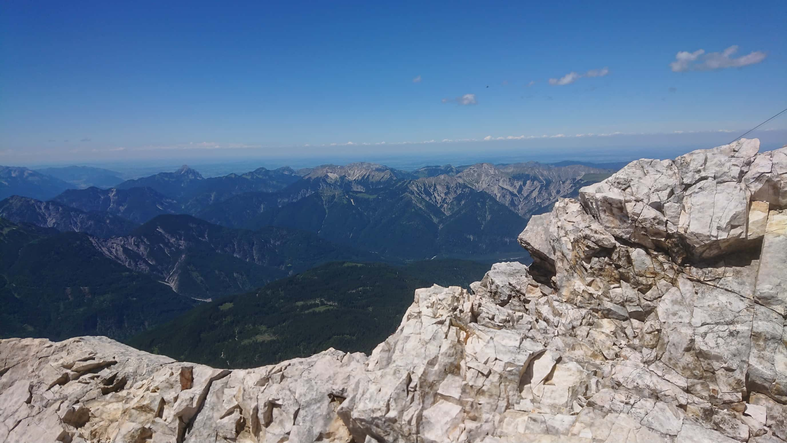
It's hard to describe what I felt in that moment. I almost cried, as I was suddenly overcome with this feeling of accomplishment. I made it!
I had to stop myself from screaming out loud. I never thought I would feel that strongly about this moment, but I did.
In any case, I hadn't really made it yet, but I was very close. I continued along the ridge towards the highest point, the Zugspitze.
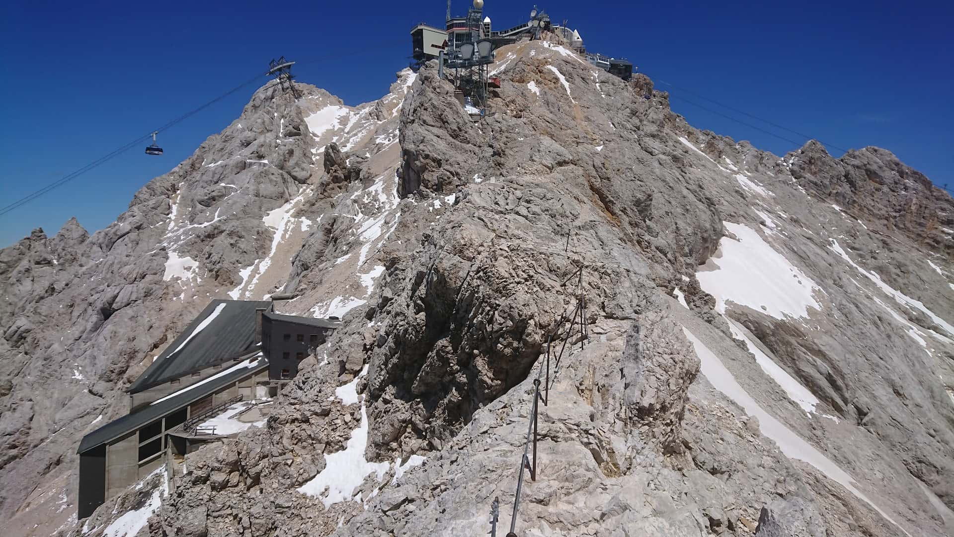
Just 20 meters from the top, I got a cramp in my left foot and had to take a short break, but after that I finally reached the platform. First thing I did was… not taking a look around and enjoying the view, but sitting down in a corner where there's some shade and not moving for the next 20 minutes. I felt absolutely tired and exhausted.
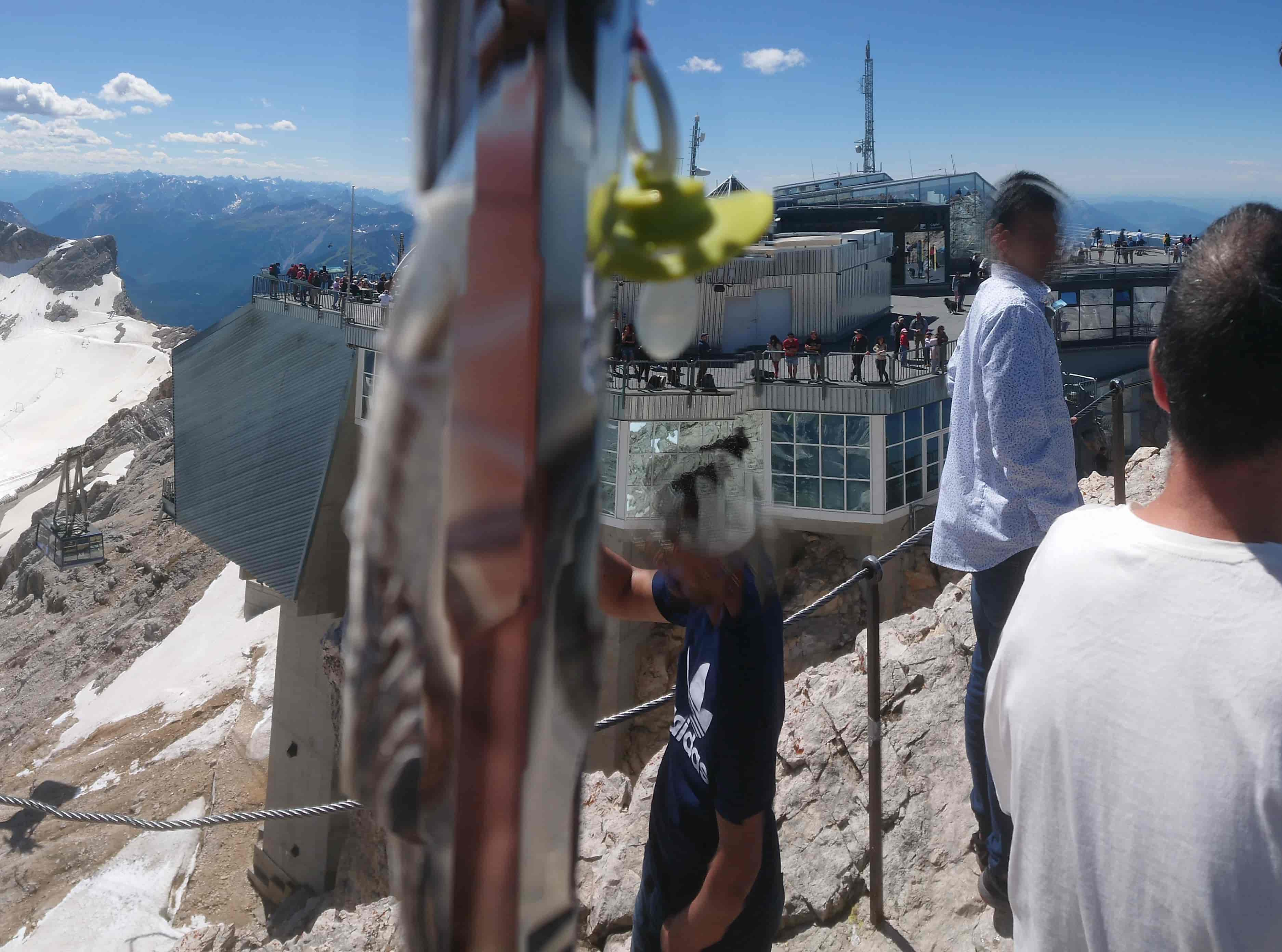
That's also why the perspective is kinda broken in some places. That big pole blocking the view in the middle is the summit cross by the way.
The platform is rather big, there were easily over a hundred people on it. I saw and heard a bunch of different nationalities, from Spanish to Scandinavian, over Indian and Chinese. That said, it was quite the weird feeling, after over six hours of making my way up there, to see old people or even mothers with their child in a stroller. They obviously didn't hike up there, but rather just took the cable cars. I couldn't imagine that and I much prefer going the hard way and “earning” it.
While I was sitting on the platform, leaning against one of the glass windows and staring emptily into the sky, an old couple passing by asked me if I was okay. When I told them I just needed a break after the hike, they said:
“But you didn't walk up here, right?”
“I did”
“From the bottom?”
“From Garmisch-Partenkirchen”
The looks on their faces… hehe.
By the way, there was only E connectivity on the first 5km of the hike and no mobile data at all after that, but once I was within a couple hundred meters of elevation of the peak, I was back in 4G territory.
After finishing my break and getting up like an old man, I took a short stroll around the platform and then made my way to the summit cross.
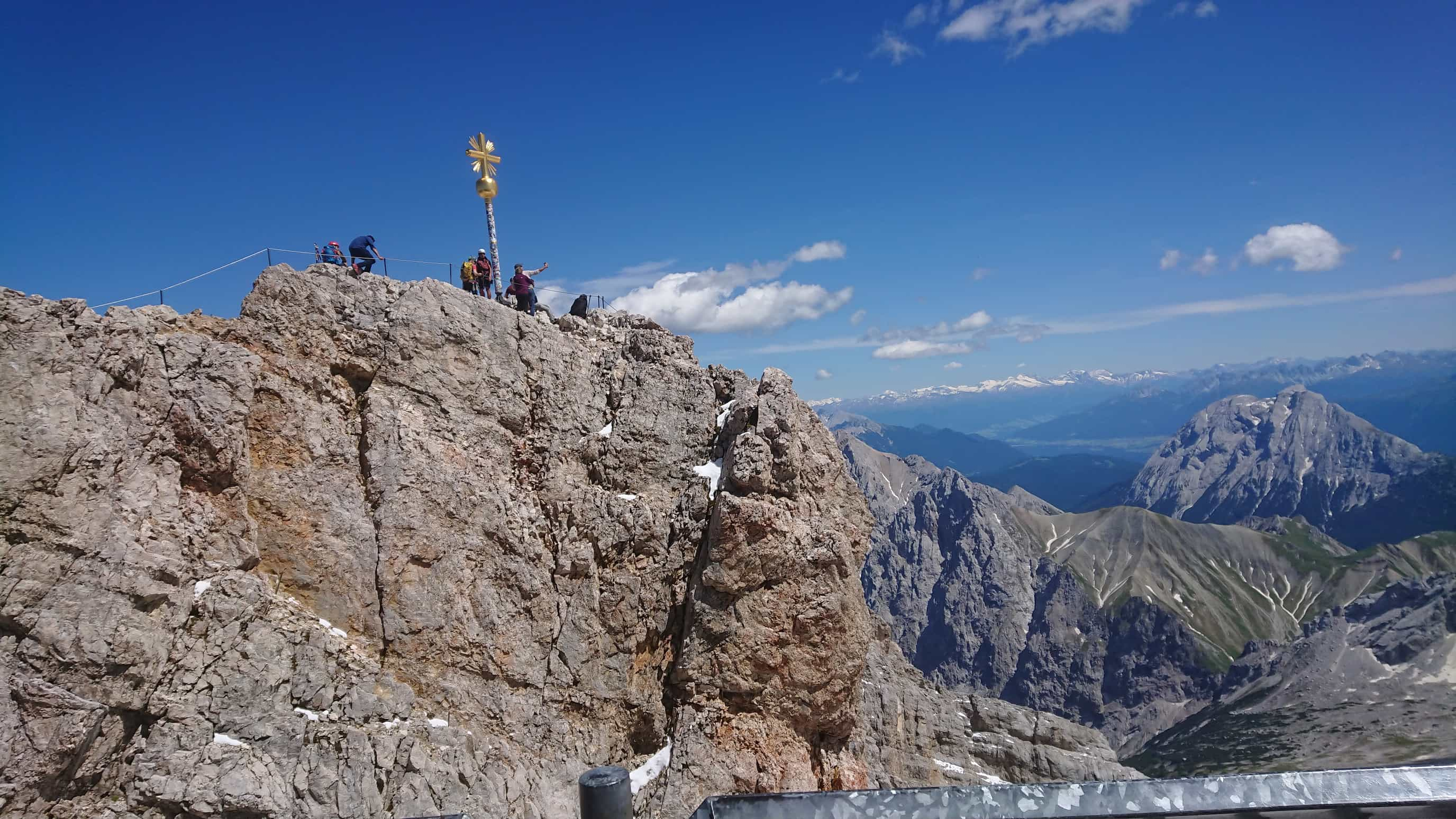
Going up there was a bit difficult. It's just about 20m from the platform, but the path is quite narrow and there's a lot of people who want to go there. I had to to stand in line for a total of three times, just to get to the cross and then back to the platform. Asked someone to take a picture of me next to the cross, took in the view for a bit, and then I prepared to go back down.
There's a cafe and a restaurant inside the platform, as well as the cable cars. I bought my tickets, and then rode down to the Eibsee in one of them. It was super cramped, but at least I got a seat. At this point I had quite the headache and felt like I could fall asleep from exhaustion any moment. I spent almost the entire ride with my eyes closed. That cost me 37.50€ by the way. Oh well, not like I had another choice since there's no way I was going to hike back down the mountain the same day. Imagining going down the same slopes I climbed up earlier also seemed much scarier than going up. From the Eibsee I took the Zahnradbahn (“gear train”) to Garmisch-Partenkirchen and waited for the bus back to Oberau. It was around 16:00, and I would soon be at home and could finally take a rest. Or so I thought…
Bonus episode: Deutsche Bahn says no
I took the SEV to Oberau, and when we arrived, there was already a train waiting for us. Quite lucky, since the trains only go once an hour and I thought we'd barely missed it. But then we realized the doors didn't open. Someone asked one of the Deutsche Bahn employees standing around nearby, but they just shrugged, took out their phone and made a call.
5 minutes later:
“Seems like the track is blocked right in front of Oberau, so the trains can't run.”
“Why?”, someone asked.
“We don't know”, the DB employee answered.
“So when will the trains run again?”
“No idea. Could be in 10 minutes, or in a couple hours”
Great, I thought, took out my e-reader and sat down on the stone plates next to the platform.
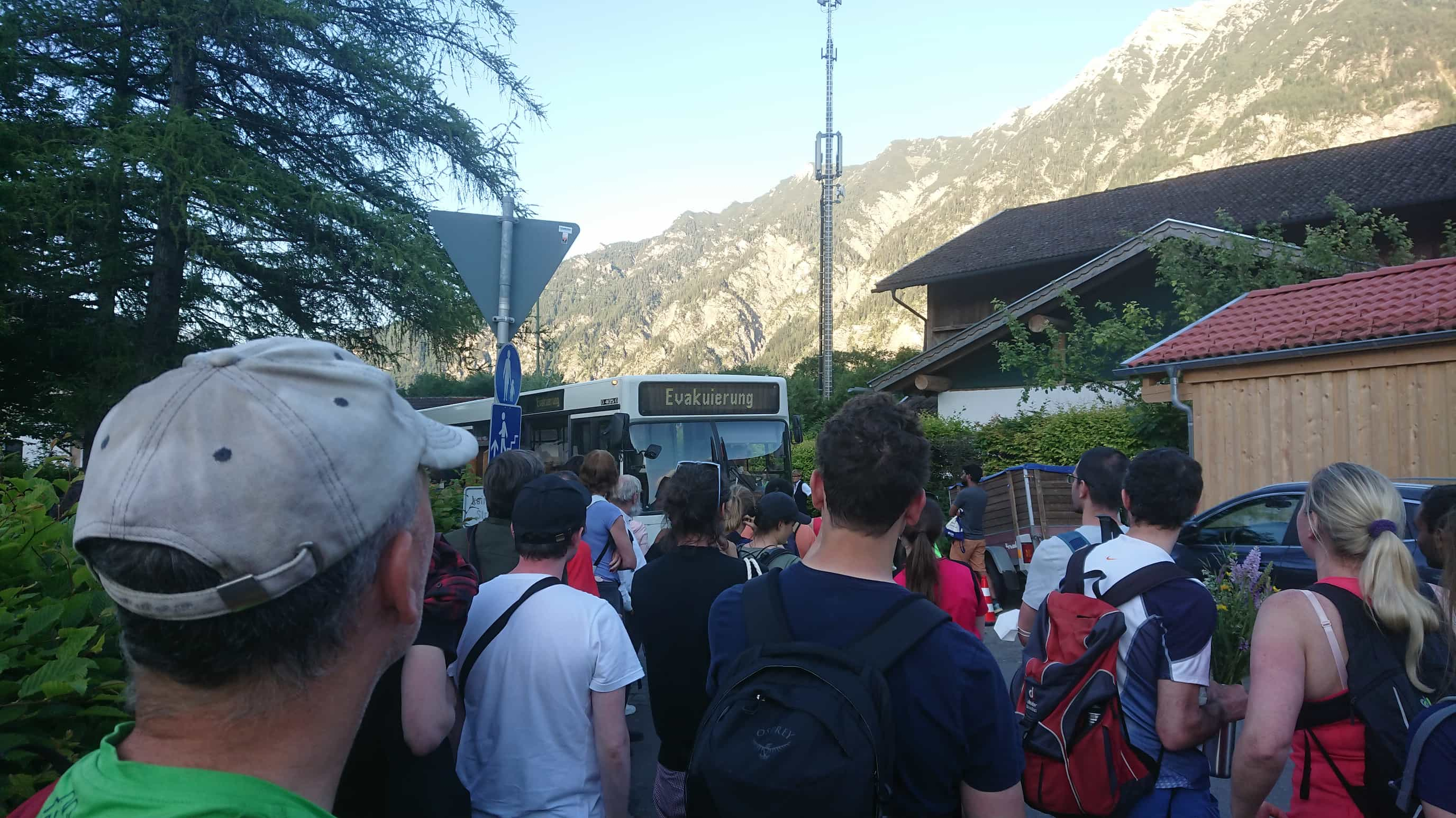
About an hour passed while more and more people arrived from Garmisch-Partenkirchen, until there were more than a hundred of us sitting and standing, spread out across the train station and waiting for something to happen. People kept pestering the DB employees about new info, but there was nothing for a while. Some people had already taken taxis at their own expenses to the next town nearby, Murnau, from which trains were still running. After about 1.5h it was 18:00 and we finally got the info that busses were planned to pick us up and bring us to Murnau. We moved to the plaza in front of the train station and started waiting for busses instead of trains. Another 30 minutes later, the first bus arrived, but it could only fit about 20 of us, since there were already a bunch of people inside. They prioritized pregnant women, families with children and elderly people, so I didn't have a chance of getting in and kept waiting for the next bus.
In the meantime, a couple taxis called by the DB employees arrived, which they used to get the elderly people out of there. Some of my fellow stranded people started to get real mad. One of them made some sort of racist comment towards one of the two DB security guys (a black man) and it got a bit heated for a moment. After another 1.5h the second bus finally arrived.
Unfortunately, this one already had people on board as well, and the bus driver said she could only fit in another 10. That said, after 10 people got in and all of them found a seat we were like
“Ma'am, can't you just let us stand?”
“Sorry we can't do that”, she answered.
“Okay, but why?”
“If we take too many people on, the bus is not gonna make it up the hill.”
Okay, wtf? Couldn't stop giggling for a while after I heard that. I'm still not sure whether this was just a really bad excuse, or if she was actually serious. Though in the latter case, if it were me, I would have gotten off the bus and just pushed if that became necessary. Oh well.
The remaining crowd, down to about 50 people, kept waiting. Another 30 minutes later, 20:30 at this point, one of these big travel busses appeared. A huge one, where everyone was immediately sure we could fit all the remaining people in there with ease. The DB employees were smiling with relief as the bus came to a stop on the parking lot next to us. One of them went over to talk to the bus driver. After a full 10 minutes of waiting, she came back and told us “Sorry, the driver's shift is over and he's going home.”
Wait, what?
We didn't believe what we just heard at first.
As if to drive the message home, we had to make some space… for the bus driver, a scrawny old man, to pass through on his bicycle, smiling and waving at us. Some of these situations are unexpectedly comedic, though I guess I may have been the only one laughing at this point.
In any case, at 21:00 another (empty!) bus finally appeared, we all managed to cram ourselves in there, got taken to Murnau and hopped on the train back to Munich from there.
I arrived at home around 23:00. At this point my legs were actually feeling pretty good and well rested again. I took off my hiking boots and socks for the first time in 16 hours and realized I hadn't taken even a single blister home from this! That is actually amazing, my feet never looked this well even after much easier hikes. I thank the hiking socks for this, an investment that I'm really happy with now.
Soooo, that's about it. All in all, my hike to the Zugspitze was a pretty cool experience. I'm very happy I got the opportunity to do this, and I'm proud of myself that I made it. The Reintal itself was a bit of a boring stretch in the middle and the way home got much longer than planned thanks to DB being DB… but other than that, this is something I can really recommend. This is also a very good opportunity to get started with mountain climbing, since the route is easy so you don't need any extra gear, it's not particularly dangerous and it's absolutely doable within a single day. Huge recommendation from my side if you ever get the chance.